
Geotimes Home | AGI Home | Information Services | Geoscience Education | Public Policy | Programs | Publications | Careers

 Shaking
in the South
Shaking
in the South
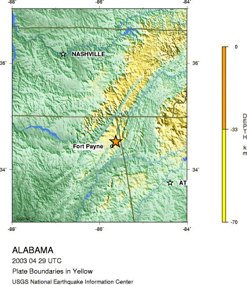
This morning, a magnitude-4.9 earthquake struck just east of Fort Payne, Ala.
Felt from North Carolina to Mississippi, the quake awoke confused southerners
from their sleep just before 5:00 a.m. "We thought it was wind; we didn't
know what it was," says a Georgia resident.
The tremor's epicenter was along the border of Georgia and Alabama, about 37
miles southwest of Chattanooga, Tenn., and 115 miles northwest of Atlanta. Since
the earthquake struck, the U.S. Geological Survey (USGS) has received more than
5,500 reports to its "Did you Feel It?" Web site. Damages though are
minimal, with reports of power outages and fallen trees.
Alabama's known seismic history spans about 100 years. The first recorded major
earthquake shook the western part of the state in February of 1886. According
to the USGS Web site, moderately damaging earthquakes occur about every 20 years
in the United States east of the Rocky Mountains. Earthquake waves travel farther
in the East than they do in the West, so an eastern quake rattles a much larger
area.
Lisa M. Pinsker
Links:
National
Earthquake Information Center
Did
You Feel It?
Yahoo
News story
|
Geotimes Home | AGI Home | Information Services | Geoscience Education | Public Policy | Programs | Publications | Careers |