Geotimes Home | AGI Home | Information Services | Geoscience Education | Public Policy | Programs | Publications | Careers

 Powerful
earthquake strikes Afghanistan
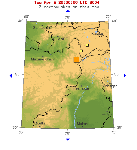
At 1:54 a.m. local time today, a magnitude-6.6 earthquake struck the eastern province of Afghanistan. The quake was centered in the remote and mountainous Hindu Kush region just south of the provincial capital, Feyzabad, according to the U.S. Geological Survey (USGS). The quake shook Kabul, about 170 miles from the epicenter, and was felt as far away as Islamabad, Pakistan, and Srinigar, Kashmir.
Impoverished villages filled with unstable mud houses are scattered throughout
the Hindu Kush region, which borders Tajikistan, China and Pakistan. Damages,
injuries and the death toll are as yet unknown from these areas. Although USGS
is reporting at least one casualty, local government officials note there are
likely to be more. Total damages are as yet unknown, and it could take awhile
for a full assessment, according to the Associated Press.
A powerful magnitude-6.6 earthquake struck
the Hindu Kush region of Afghanistan in the middle of the night on April 6.
Image courtesy of USGS.
The last major earthquake in the region was magnitude-6.9 striking in May 1998
and killing 5,000 people. Two magnitude-5 earthquakes struck northwestern Pakistan
March 10 and Feb. 22, but caused no reported injuries, and a magnitude-5.7 temblor
struck in the same region on Feb. 13 and killed 24 people, according to the
Associated Press.
Megan Sever
Links:
USGS
earthquake information
AP
story on Yahoo.com
 |
Geotimes Home | AGI Home | Information Services | Geoscience Education | Public Policy | Programs | Publications | Careers |