geotimesheader  
Geotimes Home Calendar Classifieds Subscribe Advertise

Geotimes
 Published by the American Geological Institute
Newsmagazine of the Earth Sciences

August 2000


News Notes
 Planetary Geology
Mars may hide shades of blue

June 22, WASHINGTON
While searching for the lost Polar Lander last year, a camera on NASA’s orbiting spacecraft Mars Global Surveyor 
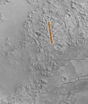
shot close-up images of seepage and runoff along the walls of martian pits, craters and valleys. The fan-shaped rivulets have shocked scientists with the idea that pockets of liquid water may still lie buried close to the surface, a discovery that may revolutionize modern theories about Mars and change the priorities of future missions.

“Actual observations pale to science fiction written,” said Mike Malin of Malin Space Science Systems, which designed the Mars Orbiter Camera. He announced his team’s findings today at a news conference at NASA headquarters. The photos set a precedent for their detail, capturing gullies “you could walk across” in a few minutes, he said.

After two years of skimming through Mars’ thin upper atmosphere on an elliptical path, Mars Global Surveyor finally slowed to a circular polar orbit last year. Once in focus, its camera zoomed in on martian landmarks like a tourist at Disneyland, providing about a hundred pictures a day. So far, more than 250 images of the 65,000 taken have shown features that look like mudflows.

“If these had been on Earth there would be no question that water was involved,” Malin said. The gullies and channels share strong resemblance to many water-worn landmarks on Earth — such as the water trails that percolated through the ash on Mount St. Helens, deltas on the Mississippi, desert flashfloods, and glacier outbursts or jökulhlaups. One gully named the “Weeping Layer,” located on the south-facing wall of a trough in the Gorgonum Chaos region, resembles the rainwater that trickles down the cliffs at “Weeping Rock” in Utah’s Zion National Park on the edge of the Colorado Plateau.

But unique to Mars, the features share a peculiar habit of growing like moss in areas facing away from the sun. They also tend to appear in clusters located outside the equatorial region, such as Gorgonum Chaos, Vallis Nirgal and Dao Vallis, mostly between 30 and 70 degrees latitude in both hemispheres. “My confidence was severely shaken by this discovery,” Malin said. “I couldn’t put it into context with the understanding I’ve gained from working on Mars for the past 30 years.”

Although the red planet is known to harbor water locked up as ice at its poles and as vapor in the atmosphere, scientists considered the martian surface mostly too cold for liquid water. They thought water only had a chance of existing as liquid beneath the heated rocks of the equator.

Malin and colleague Ken Edgett, who selected the imaging targets for the Mars Orbiter Camera, reported their discovery in the June 30 Science. Taking into consideration the landmarks’ relationship to sunlight and latitude, they hypothesized that water might exist in reservoirs around the planet but evaporate on contact with the surface.

Water seeping through the ground boils as it hits the low atmospheric pressures on Mars, “but its steam is not hot, like in your kitchen, but cool,” Malin said. These may be violent events, he says, with “boiling, freezing and gravity fighting it out, and the question is which one wins.”

In shady areas, Malin and Edgett believe, the water freezes and forms ice dams that then burst from the buildup of water pressure behind them. The catastrophic blowouts transfer soil and rock along unique martian mudflows that form earthlike aprons of debris at the end of the channels.

“We should reexamine the commonly held view that only during the first billion years of the planet’s history or in association with geothermal events was Mars warm enough to produce shallow groundwater discharges,” commented Kenneth L. Tanaka of the U.S. Geological Survey in the June 30 Science.

Indeed, the events may be as young as the shutter speed on the camera (two seconds), but with no impact marks from craters they remain ageless — the fountains of youth, as Tanaka described them.

Malin and Edgett’s hypothesis that water is the force behind these features may be difficult to disprove. “I don’t believe this story will be answered until someone goes to one of these cliffs with a pick and shovel and digs into it,” Malin said.

Until then, the eagle-eyed orbiter will return images of features already identified. “We’ll keep taking pictures, and if we see one that changes  — wow!” Edgett said. “We’ll be back.”


Above left: A series of troughs and layered mesas in the
Gorgonum Chaos region of the martian southern hemisphere. 
The Viking view directly above shows the location of the Mars 
Orbiter Camera image (shown at top). Seeping groundwater appears to 
emanate from a specific layer near the tops of trough walls, 
particularly on south-facing slopes (south is toward the bottom 
of each image). The large number of gullies associated with 
the same layer in each mesa suggests that this layer may be 
particularly effective in storing and conducting water. An 
expansive aquifer may be present less than a few hundred
meters beneath the surface.  Both images courtesy of NASA.
Christina Reed


Geotimes Home | AGI Home | Information Services | Geoscience Education | Public Policy | Programs | Publications | Careers

© 2024 American Geological Institute. All rights reserved. Any copying, redistribution or retransmission of any of the contents of this service without the express written consent of the American Geological Institute is expressly prohibited. For all electronic copyright requests, visit: http://www.copyright.com/ccc/do/showConfigurator?WT.mc_id=PubLink