Geotimes

For Students
The Rocks Rediscovered: Confessions
of a die-hard hydrogeologist
Donald I. Siegel
 Last summer,
I developed a hydrogeology segment for the University of Missouri’s geology
field camp in the Wind River Range of southwestern Wyoming. As I took the students
through the Wind River Range, I rediscovered the magic of rocks — something
that I had forgotten in the past 25 years of practicing and doing research in
hydrogeology.
Last summer,
I developed a hydrogeology segment for the University of Missouri’s geology
field camp in the Wind River Range of southwestern Wyoming. As I took the students
through the Wind River Range, I rediscovered the magic of rocks — something
that I had forgotten in the past 25 years of practicing and doing research in
hydrogeology.
When I was a kid, I was fascinated by rocks, minerals and, of course, dinosaurs.
I also loved the outdoors and geology was the perfect professional match for
me. As part of my studies for a bachelor’s in geology, I attended an eight-week
summer geology field camp. I acutely remember the camp’s “hike from
hell” straight up a mountain to learn the stratigraphic section, as well
as wonderful field trips to the great geologic attractions: Yellowstone National
Park, the Grand Tetons and Glacier National Park. I count among my professional
colleagues the student friends I made during that experience.
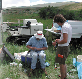
Donald Siegel started a hydrogeology field
trip last summer, and in the process rediscovered why every geologist needs
to know the rocks. Courtesy of D. Siegel
After my bachelor’s, I used some of what I learned at field camp to map
Pleistocene and Pliocene lake sediments in Africa, then earned a master’s
and joined the oil industry. Much of what I did in the “oil patch”
was “geology by geophysics.” I did some fieldwork, but I mostly tried
to figure out deep subsurface geologic relationships from a few geologic logs,
sometimes tied into seismic profiles. For my doctorate in hydrogeology, I studied
the hydraulics and geochemistry of interactions between surface water and groundwater
in a till-covered watershed. I then analyzed the dissolved solids in waters
and mathematically “reconstructed” rocks from the solutes they had
become. In some sense, I was twice removed from actually seeing rocks in my
work.
Since earning my doctorate, I have done what modern hydrogeologists do: I mathematically
simulate the flow of water and chemical mass in aquifer systems, characterize
the fate and transport of groundwater contaminants and study wetland-groundwater
interactions. I have had an excellent career as a hydrogeologist. I love my
science. But I forgot how important my intensive field camp experience from
more than 30 years ago has been to my career.
It has been fashionable recently for academic hydrogeologists, myself included,
to dismiss geologic field camps that emphasize geologic mapping as anachronisms
of a bygone scientific age. “Who maps surface geology anymore?” is
a typical comment. Many geology students now go to summer hydrology field camps
where they install monitoring wells, collect water samples, measure streamflow,
do pumping tests and map water tables. They don’t map much rock. I certainly
agree that geology students need some intensive hydrologic training along with
other geologic study; otherwise I wouldn’t have agreed to work at the Missouri
Camp. So why am I harping about “the rocks?”
The reason is this: hydrogeologists routinely have to interpret subsurface structure
and stratigraphic relationships from data that is often even more scant than
that found in the petroleum industry. Even more, hydrogeologists have to try
and develop remediation strategies for contaminant distributions that often
have incomplete data. How can a hydrogeologist adequately picture the subsurface
in three dimensions if he or she has never seen it, felt it, walked it or experienced
it?
I draw the analogy to studying languages. I have never known a student who,
after studying a foreign language for four years in typical academic fashion,
could fluently speak the language if suddenly dropped into a foreign country.
Language fluency is learned by immersion, something that the Peace Corps has
known for years. Through this immersion, Peace Corps applicants either learn
the language, or they don’t eat. Similarly, students at summer geology
field camps are immersed in geology for more than 12 hours a day. Spending time
mapping and drawing cross-sections is, fundamentally, not so much about learning
mapping skills as it is about learning how to “see” Earth in three
dimensions over time, and about developing a mental database of geological images
that last a lifetime.
John McPhee once wrote that if properly trained, geologists can mentally travel
back in time, “seeing” in rock outcrops the paleo-landscapes of the
past. He is right. Sometimes students ask me how I “know” from scant
data where to pinch out a sand body in a lithologic facies map, or whether displaced
strata reflect faulting or folding, or where contaminants are most plausibly
found. Of course I don’t “know” these things for certain, but
I draw upon what I saw in three dimensions long ago in the Rockies: the different
faults, cross-cutting relationships and sedimentary facies. Even my perspective
on glacial sedimentary and structural relationships was conditioned by my Rocky
Mountain experience. In the Rockies, strata are fabulously laid bare, visible
for miles. Glacial deposits are slathered against the rocks like so many layers
of frosting. What better way is there to see how glaciation temporally sculpts
the landscape?
I no longer think that a hydrogeologist can be well trained without an intensive
experience solving complex, 3-D patterns in rocks. The best way to gain this
is experience is by walking along outcrops, thinking, mapping, re-mapping and
drawing cross- sections. I rediscovered in the Wind River Range how important
my own geology field camp experience has been to my professional development
and success. A rigorous geology field camp experience transforms the geology
student into a bonafide, journeyman geologist. The root of “hydrogeology”
is geology, and geology remains the root of my profession.
Siegel is a Professor of Earth
Science at Syracuse University. He is past chairman of the Hydrogeology Division
of the Geological Society of America, and received the Division’s Distinguished
Service Award this year. E-mail.
