
Geotimes Home | AGI Home | Information Services | Geoscience Education | Public Policy | Programs | Publications | Careers

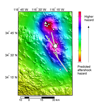 Aftershocks can
pose a serious threat to populated areas already hit by an earthquake. In 1999,
following the deadly magnitude-7.4 quake in Izmit, Turkey, a magnitude-5.8 aftershock
struck the area, killing seven people and injuring 420. Three hours after the
magnitude-7.3 Landers earthquake shook Southern California on June 28, 1992, a
magnitude-6.4 aftershock shook the area, creating more property damage than the
initial earthquake.
Aftershocks can
pose a serious threat to populated areas already hit by an earthquake. In 1999,
following the deadly magnitude-7.4 quake in Izmit, Turkey, a magnitude-5.8 aftershock
struck the area, killing seven people and injuring 420. Three hours after the
magnitude-7.3 Landers earthquake shook Southern California on June 28, 1992, a
magnitude-6.4 aftershock shook the area, creating more property damage than the
initial earthquake. People in Iran are still attempting to recover from a devastating earthquake
that struck the western region of the country on June 22. The earthquake that
occurred at 7:28 a.m. in Iran recorded a magnitude of 6.3, according to the
International Institute of Earth Engineering and Seismology in Iran. Tremors
were felt in Iran’s capital, Tehran, which lies 225 kilometers east of
the earthquake’s epicenter.
In the immediate vicinity of the earthquake, the damage was overwhelming. Villages
have been completely destroyed in the main event and its ensuing aftershocks.
The government estimates a death toll of approximately 250 people, with at least
1,300 injured and thousands homeless. The abundance of aftershocks immediately
following the earthquake have the villagers in fear of more damage.
Earthquakes are a relatively common occurrence in this region, which lies along
the Zagros fold and thrust belt where the Arabian and Eurasian plate boundaries
collide. But this is the largest quake to have occurred since 1997, when an
earlier earthquake of magnitude 7.1 (located 300 kilometers north of the present
earthquake) killed an estimated 1500 people.
Poorly constructed houses contributed heavily to the present damage, and liquefaction
of the soil in some areas aided destruction. Relief aid, though offered by many
countries, including the United States, has been slow in arriving, leaving the
homeless struggling to come to terms with the crisis.
Salma Monani
|
Geotimes Home | AGI Home | Information Services | Geoscience Education | Public Policy | Programs | Publications | Careers |