Geotimes
News Notes
Human health
Mapping West Nile virus

Earth scientists 
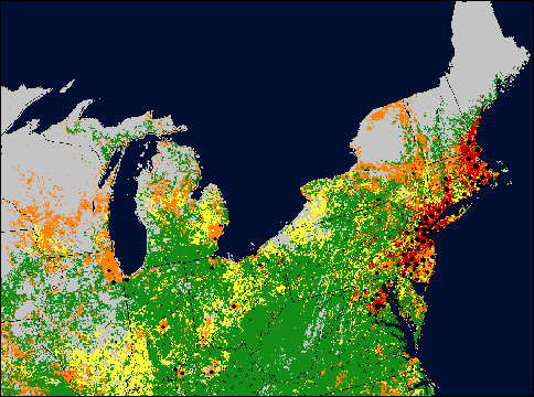
are stepping into the frontlines of the public health community’s fight to track, understand and prevent West Nile virus. Using satellite data, researchers at the National Aeronautics and Space Administration (NASA) are changing the way outbreak experts look at the disease.

The more than 30 mosquito species that carry West Nile virus and the migratory birds that can spread the disease to other mosquitoes all need specific environmental conditions to thrive. From satellite imagery, NASA researchers are identifying features that can create such conditions, including patterns of vegetation, rainfall and land-surface temperatures, says Robert Venezia, NASA program manager for Public Health Applications.

This West Nile virus sample risk map for the northeast United States comes from NASA satellite data combined with disease control data from the CDC and state health departments. The small circles represent uninfected crows reported in 2001. Black dots indicate infected crows; larger dots reflect a higher concentration of infected crows in one area. The colors represent relative levels of risk for the virus in 2001 as determined by NASA scientists. Image by the International Research Partnership for Infectious Diseases.


Venezia began working on the West Nile virus project two years ago while working as an environmental epidemiologist with the Maryland Department of Health and Mental Hygiene. “The opportunity to help NASA build a counterpart program was very compelling,” he says.

At NASA, public health and earth system scientists are currently evaluating the technology and methods for tracking the virus through a joint analysis with the Centers for Disease Control and Prevention (CDC), National Institutes of Health, Environmental Protection Agency, U.S. Geological Survey (USGS) and local health departments. They hope to create risk maps of the virus that will help agencies predict and respond to the emerging disease.

West Nile virus causes flu-like symptoms and can be fatal to people with compromised immune systems. As of Nov. 1, this year has seen 201 fatalities among the 3,475 cases of the virus in 39 states and the District of Columbia. The medical community has been tracking the spread of the disease since 1999, when it first appeared in the United States. Traditionally, their tools of surveillance have included following bird migration patterns, and counting and geographically mapping birds that have died from the virus.

States can combine these traditional tools with the new tools created by NASA, and then integrate it all into surveillance based on GIS (geographic information) systems. “Federal, state and local health departments are increasingly turning to GIS and remotely sensed information as tools for investigating and responding to infectious and environmentally related diseases,” Venezia says.

Eric Conrad, a trained coastal geologist and deputy secretary for field operations at the Pennsylvania Department of Environmental Protection, has spearheaded the Pennsylvania West Nile Virus Surveillance System, which uses both GIS and satellite data to link the state’s agriculture, environmental and health departments. “We collect information across the Commonwealth for mosquitoes (adults and larvae), and track cited and reported dead birds, sentinel chickens and horses. We’re then able to compare that information with environmental factors and make decisions on what type of control we need to take for when and where,” Conrad explains.

The NASA data are beginning to help the Pennsylvania researchers identify climate patterns that may affect mosquito seasons. Eventually Conrad would like to see a statistical correlation between climate and mosquito behavior. Anecdotally, he says, they have seen southern mosquito species moving north over the past decade. The satellite data could explain that trend through vegetation cover or temperature change.

Since the system began operating in the spring of 2000, it has garnered more than 500 users from 67 counties. The system automatically uploads information to the CDC for weekly reports and has a public Web site with general information updated daily.

While Pennsylvania has one of the highest numbers of positive reports of West Nile virus in carrier animals in the nation, it has one of the lowest numbers of human cases of the virus, Conrad says. And Pennsylvania is sharing its information with other states, such as New Jersey, which are also developing disease surveillance systems.

Since April 2001, New York has also been working on a similar system with the help of Oxford University and NASA’s International Research Partnership for Infectious Diseases, says Bryon Backenson of the New York State Department of Health. The project is still in its modeling phase, he says, and they are finding that “maps can be made that accurately describe areas where West Nile virus has been found.”

These statewide efforts should come as good news to federal agencies eager to strengthen the nation’s response to virus outbreaks. “We have made substantial progress to date in enhancing the nation’s capability to detect and respond to an infectious disease outbreak; however, the emergence of West Nile virus in the United States has reminded us yet again that we must not become complacent,” Roger Nasci, a research entomologist for CDC, told the House Subcommittee on Water Resources and the Environment at a hearing on Oct. 10. “A strong and flexible public health infrastructure is the best defense against any disease outbreak.”

Lisa M. Pinsker

Visit the Pennsylvania West Nile Virus Surveillance System Web site.

Geotimes Home | AGI Home | Information Services | Geoscience Education | Public Policy | Programs | Publications | Careers

© 2024 American Geological Institute. All rights reserved. Any copying, redistribution or retransmission of any of the contents of this service without the express written consent of the American Geological Institute is expressly prohibited. For all electronic copyright requests, visit: http://www.copyright.com/ccc/do/showConfigurator?WT.mc_id=PubLink