
Geotimes Home | AGI Home | Information Services | Geoscience Education | Public Policy | Programs | Publications | Careers

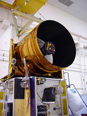
The Geoscience Laser Altimeter System, pictured here during its construction, is the sole scientific instrument on the ICESat satellite. Image provided by NASA.
In places across the globe, geoscientists have observed that rising temperatures are melting glaciers, and that the melt-water is contributing to the current, observed sea-level rise of a few millimeters each year. However, in the vast and largely inaccessible areas of the poles, the data are unclear and the stakes are high. Together Greenland and Antarctica contain 77 percent of Earth's freshwater and, if they melted altogether, they would raise sea level by 7 meters.
The satellite is equipped with a Geoscience Laser Altimeter System that will precisely measure the elevation of the ice sheets to within an accuracy of 1.5 centimeters for parcels of ice 100 kilometers by 100 kilometers. The satellite will scan the ice sheets along a series of pre-determined tracks. "The orbit spacing is quite close; it will almost blanket the ice sheets with orbit tracks," says NASA glaciologist Robert Thomas. By repeating the same tracks once every 183 days, the satellite will produce data detailing changes in elevation over time. Glaciologists can convert the elevation data into maps showing where, and to what degree, the ice sheets are growing and retracting.
The satellite will measure the elevation of the ice sheets by emitting pulses of light that travel down to the ice sheets, bounce off the ice, and return to the satellite. The time that it takes for a laser pulse to complete its trip is directly proportional to the distance between the satellite and the ice surface. A network of Global Positioning System receivers will measure the position and height of the satellite at all times. Using that data, researchers can infer the elevation of the ice surface relative to a common reference point.
With the new satellite data, NASA geoscientists expect to be able to know how much polar ice sheets are contributing to current sea-level rise to within an accuracy of 0.1 centimeters per decade. That is more than 10 times more accurate than previous estimates; past uncertainties about ice sheet contributions have been as large as the observed sea-level changes themselves. Previous research projects have based estimates on data from other satellites that were not designed specifically to monitor the poles, from low-flying aircraft, and from measurements made in the field.
ICESat will not just monitor polar ice sheets. It will also measure the elevations
of clouds and aerosols, elucidating the ways in which these features affect
climate. And it will produce a high-accuracy elevation data set of selected
portions of Earth's land surface, serving as a reference for evaluating and
improving topographic maps acquired by other air-borne and space-borne methods.
Greg Peterson
Links:
ICESat
homepage, University of Texas
ICESat animations, Goddard Space Flight Center
|
Geotimes Home | AGI Home | Information Services | Geoscience Education | Public Policy | Programs | Publications | Careers |