
Before: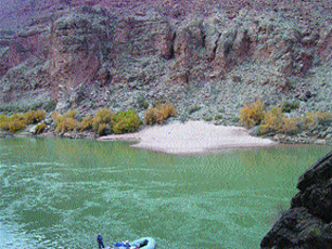 After: 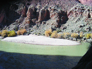 A sandbar downstream of Glen Canyon Dam, at the 30-mile mark on the Colorado River, gained area and volume after an experimental flood last November. [For comparison, note the gap between bushes above the beach.] Courtesy of Mark Schmeeckle, Arizona State University. |
Naomi Lubick
Links:
USGS
Flow Reports for flooding from Glen Canyon Dam, 2004
USGS
Information on the flood in 1996
Back to top
 |
Geotimes Home | AGI Home | Information Services | Geoscience Education | Public Policy | Programs | Publications | Careers |