 The
bumper sticker plea to Reunite Gondwanaland is not just a plate tectonic
parody on todays shifting political boundaries. Scientists are now reuniting
the Cambrian southern landmass, on paper.
The
bumper sticker plea to Reunite Gondwanaland is not just a plate tectonic
parody on todays shifting political boundaries. Scientists are now reuniting
the Cambrian southern landmass, on paper.

The
bumper sticker plea to Reunite Gondwanaland is not just a plate tectonic
parody on todays shifting political boundaries. Scientists are now reuniting
the Cambrian southern landmass, on paper.
For the last 10 years, geologists have debated how this supercontinent consisting of Africa, South America, India, Australia and Antarctica came together some 500 million years ago. It was clear that in Precambrian time, an east-meets-west collision united Antarctica, Australia and India with Africa and South America. But Antarctica, Australia and India did not act as a single massive unit in this endeavor, as was thought.
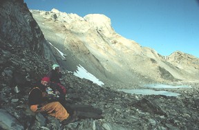
[At right: Working in the southern Prince Charles Mountains, Antarctica. Courtesy of Steve Boger.]
Previous global tectonic studies have commonly assumed that Antarctica is one single piece of Precambrian crust with no internal divisions, says Ian Fitzsimons of Curtin University of Technology in Perth, Australia. But this interpretation owes more to the ice sheet that obscures over 98 percent of the continent than to geological reality. Short of drilling numerous holes in the ice cap or waiting for global warming, geologists have few windows to Antarcticas past. One place to look, however, is near the Lambert Glacier and the Prince Charles Mountains about 700 kilometers inland from the Antarctic coast.
In the May issue of Geology, Steve Boger and Chris Wilson of the University of Melbourne and Mark Fanning of the Australian National University in Canberrra redefined East Gondwana to include Australia and most of Antarctica. They also established the identity of a third block of land called Indo-Antarctica, which included India and a small proportion of modern Antarctica: the northern Prince Charles Mountains, Rayner Complex and the Lambert terrane of the southern Prince Charles Mountains. It was this Indo-Antarctic continent that first hit West Gondwana along the Mozambique suture, they say. East Gondwana, with the rest of the Antarctic parts, came separately.
Scientists agree that Africa and South America joined to form West Gondwana during the Neoproterozoic, about 650 million years ago. But the other three continents had supposedly come together much earlier, during the Mesoproterozoic, about 1 billion years ago. This model also considered East Gondwana tectonically stable.
But in 1992, geochemists began questioning the stability of Antarctica after finding minerals 550 million years old on the east Antarctic coast in Prydz Bay. By the mid-1990s, uranium-lead dating of the mineral zircon made it clear that Antarctica bore some previously missed scars, indicating a tectonic past. Still, few studies had determined where the scars went.
Now we can more-or-less place our finger on the suture in the Mawson Escarpment of the southern Prince Charles Mountains thanks to the work of Steve Boger, Chris Wilson and Mark Fanning, Fitzsimons says. Previous studies by Fitzsimons and others had noted the possibility of this sutures existence, but Bogers study is the first to establish that the suture, which marks where Indo-Antarctica and East Gondwana collided, traveled inland from Prydz Bay. Boger and colleagues suggest in their paper that this collision or orogenesis may have occurred last in Gondwanas formation about 500 million years ago, shortly after Indo-Antarctica had joined with West Gondwana along the Mozambique suture. But the timing of these events is still contentious as dates on both sutures overlap by 5 million years.
At least two major sutures have now been identified cutting through the continent, each representing a geological seam along which Gondwana was stitched together, Fitzsimons says.
Boger and his colleagues did not start out looking for indications of continental collision. Based on our field observations I had actually concluded that much of the southern Prince Charles Mountains was probably the same age as the northern Prince Charles Mountains, about one billion years old, he says. Instead he found the southern Prince Charles Mountains to be 500 million years old, half the age of the northern range.
Previous expeditions by Soviet scientists to the southern Prince Charles Mountains indicated a province boundary, where the geologic history of the area differed from the rest. But it took the work Boger presented to provide a no-doubt indication of a suture stretching from Prydz Bay inland to the southern Prince Charles Mountains. In doing so, they have also demonstrated that the early Soviet workers were spot on in their identification of major terrane boundaries, Fitzsimons says.
Boger used a dating technique that has been widely applied in Antarctica to produce precise zircon ages. During formation, zircons are essentially lead-free but absorb uranium. As zircons age the uranium decays into lead. Boger measured the ratio of uranium to lead using a mass spectrometer known as a sensitive high-resolution ion microprobe, or SHRIMP, developed at the Australian National University.
But Antarctica is still keeping many of its secrets, Fitzsimons says. The pathways taken by these sutures through the ice-covered interior of the continent will remain unknown until we gain some understanding of the continental structure beneath the ice cap. And he would rather not wait for global warming, he says.
Christina Reed
 |
Geotimes Home | AGI Home | Information Services | Geoscience Education | Public Policy | Programs | Publications | Careers |