
Geotimes Home | AGI Home | Information Services | Geoscience Education | Public Policy | Programs | Publications | Careers

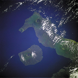 Astronauts have
a view of Earth like no one else. And since the birth of the space program, they
have taken photographs of the planet to share with the world. As reported in the
April 23 Eos, astronaut photography of Earth has now achieved a new level of spatial
resolution.
Astronauts have
a view of Earth like no one else. And since the birth of the space program, they
have taken photographs of the planet to share with the world. As reported in the
April 23 Eos, astronaut photography of Earth has now achieved a new level of spatial
resolution. Water vapor is the most abundant greenhouse gas on Earth, significantly contributing
to global climate. Since the beginning of greenhouse gas climate modeling, global
climate models have shown that when atmospheric and surface temperatures increase,
so too does the atmosphere’s ability to hold more water vapor. This additional
water vapor absorbs heat, instead of allowing the energy to escape into space.
Earth’s surface then warms — once again increasing the amount of water
vapor and warming the planet.
Climate modelers estimate that this never-ending feedback doubles how sensitive
surface temperature is to an increase in human-produced greenhouse gases. But
some climatologists think the climate system is less sensitive to greenhouse
gases than the models suggest — creating an area of contention in climate
science. Understanding the water vapor feedback is crucial to correctly modeling
future changes in Earth’s climate.
In the past, climate scientists have looked at heating variations for specific
regions in order to study the role of water vapor in climate change. But reporting
in the April 26 Science, Brian Soden of Princeton University and colleagues
take a more global approach. They observed how the 1991 eruption of Mount Pinatubo
in the Philippines created a global cooling pattern. Co-author Alan Robock of
Rutgers University says Pinatubo provided a “natural climate experiment”
to test model predictions of how water vapor behaves in the atmosphere.
Soden’s team observed a decrease in water vapor as the upper atmosphere
cooled after Pinatubo’s eruption. Their model simulated the temperature
change correctly for the water vapor feedback. This means, Robock says, that
the sensitivity of global climate models to greenhouse warming has also been
correct.
“A volcanic eruption has more in common with the type of climate perturbation
we’ll get from an increase in greenhouse gases than other previous phenomena
looked at. This is a good piece of work that is drawing on a current climate
perturbation that we can observe,” says Tony Del Genio, a physical scientist
at NASA Goddard Institute for Space Studies.
Soden’s team, he says, looked at the response of water vapor to global
cooling in order to look at the reverse scenario — warming from increases
in greenhouse gases. “It is perhaps as close as we’re going to get
to an example in the current climate that we might use to learn something about
how well our models can predict the future climate.”
Lisa M. Pinsker
|
Geotimes Home | AGI Home | Information Services | Geoscience Education | Public Policy | Programs | Publications | Careers |