Watching a sloshing Earth

| GPS studies
Watching a sloshing Earth |
|
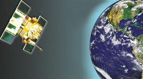
From space, the subtle shifts of Earths gravity are normally tracked using a handful of satellites that orbit close to home. Now scientists reporting in the September issue of the journal Geophysical Research Letters have found that the higher orbiting satellites of the Global Positioning System (GPS), developed by the U.S. Department of Defense, are also sensitive to the flexing motions of air and water that redistribute Earths mass.
The GPS is a constellation of 24 to 26 satellites orbiting 20,000 kilometers overhead. In contrast, the near-earth satellites, such as LAGEOS I and II, orbit below an altitude of 6,000 kilometers. For years, scientists have known these closer satellites changed their orbits slightly due to sloshing motions of the atmosphere, oceans and continental hydrology snowfall, changes in aquifer and groundwater reservoirs and the depth of lakes and streams shifting Earths gravitational pull. The effect of air and water is small, but because satellites orbiting Earth are dominantly influenced by Earths gravity, these changes in mass distribution alter the satellite orbit in a way that is predictable and observable because the influence accumulates with each orbit, says Clark Wilson of the University of Texas at Austin.
But few suspected the high-orbiting GPS satellites could feel such nontidal changes. Thomas Johnson, Peter Kammeyer and Jim Ray of the U.S. Naval Observatorys Earth Orientation Department in Washington tested five years of GPS data to find out.
The team works to solve for Universal Time GPS, or the change in the GPS satellites collective orbit. This orbit varies as Earth rotates faster or slower, and this variation needs to be corrected for in the times GPS satellites convey times used for navigation. As solving for Universal Time GPS has become more refined they now solve for the variations daily, Johnson says so has what can be understood from the orbits changes. Were getting better, the noise is getting smaller, and were starting to understand what we see, he says.
The noise co-author Kammeyer was seeing in his modeling of the satellites orbit proved to be evidence of how changes in the oceans, atmosphere and groundwater alter Earths rotation. The team matched their data with global atmospheric and ocean models. As water evaporates from the oceans and enters the atmosphere, Earths rotation changes, just as an ice skater spins slower when she puts her arms out, Johnson says. They also matched their noise with a global record of the amount of moisture in the top layer of Earths soil and the depth of its snow cover.
The abundant GPS satellites with their daily updates have an advantage over the few near-earth satellites, which are updated less often. The discovery shows that GPS satellites are a tool for monitoring gravitational field variations.
The immediate significance is that we now have a way to improve the orbit models for GPS satellites, allowing the GPS constellation to serve as a more stable reference frame for positioning on the Earth, Wilson says. The more intriguing long-term significance is that the GPS constellation provides a way to monitor a global feature of the climate.
At longer periods, the satellites might pick up drought cycles on land, sea-level rise due to melting ice caps, and other effects that are important in changing the gravity field, such as postglacial rebound.
Modelers using the GPS satellites for long-term climate change predictions can now see that some of their variations are not caused by orbit modeling error or solar radiation, but are caused by the atmosphere, oceans and continental hydrology, Johnson says. Researchers down the hall from me work on models and have errors when they look over long periods of time. The stuff they find as noise and error are my signals.
Christina Reed
 |
Geotimes Home | AGI Home | Information Services | Geoscience Education | Public Policy | Programs | Publications | Careers |