Mountains: Geology, Natural History, & Ecosystems
by Martin F. Price, Voyageur Press (2002). ISBN 0-89658-251-5. Paperback. $16.95.

Book Review will return next month.
Maps
On the Shelf
As part of the U.S. Geological Survey’s STATEMAP program, which funds
mapping projects of individual states, the Illinois State Geological Survey
has been mapping surficial and bedrock geology of the St. Louis Metro-East region
— the metropolitan area of St. Louis that is in Illinois — and suburban
areas west of Chicago. Understanding the geology of these regions is vital to
the growth and economic health of the communities within these areas. Urban
and suburban development is quickly spreading over sensitive terrains and valuable
resources. Geologic mapping can provide information that planners, developers
and resource managers need to identify and avoid hazards and to preserve mineral
and groundwater resources.
Surficial and bedrock geologic maps of the Alton, Elsah and Grafton quadrangles
in the St. Louis Metro-East area were high priorities because of hazards associated
with karst terrain, such as groundwater contamination and potential for subsidence,
and because these areas host calcium-rich, high-quality limestone used in the
production of portland cement and for coal-fired power plants. Zoning laws currently
prohibit new quarry development while allowing suburban development to surround
active quarries and cover high-quality, potential stone resources. Mapping has
allowed the Illinois survey to identify high-quality limestone resources that
sprawl has not yet made inaccessible.
Surficial maps of the Elburn and Geneva quadrangles west of Chicago reveal an
area covered by 100 to 250 feet of glacial drift, including thick, proglacial,
fluvial sand and gravel deposits that intertongue with tills deposited by Wisconsin
and older glacial events. Near the surface, sand and gravel deposits are significant
sources of aggregate, while the subsurface hosts major sources of groundwater.
The mapping identified possible interconnections between surficial fluvial deposits
and deeper aquifers that are potential areas of rapid groundwater recharge as
well as contamination pathways.
Following are new maps in the survey’s IGQ (Illinois Geologic Quadrangles)
Series.
IGQ Alton-SG. Surficial geology map, Alton quadrangle (Illinois Portion),
Madison County, Illinois by David A. Grimley. 1999. Scale, 1:24,000. Inset
maps. $10.50.
IGQ Elsah-SG. Surficial geology map, Elsah 7.5-Minute Quadrangle (Illinois Portion), Jersey and Madison Counties, Illinois by David A. Grimley. 2002. Scale, 1:24,000. Includes cross section and figures. $10.50.
IGQ Grafton-BG. Bedrock geology map, Grafton Quadrangle (Illinois Portion), Jersey and Calhoun Counties, Illinois by F. Brett Denny and Joseph A. Devera. 2002. Scale, 1:24,000. Includes cross section and geologic column. $10.50.
IGQ Elburn-SG. Surficial geology map, Elburn Quadrangle, Kane County, Illinois by David A. Grimley and B. Brandon Curry. 2001. Inset maps. $10.50.
IGQ Geneva-SG. Surficial geology map, Geneva 7.5-Minute Quadrangle, Kane County, Illinois by David A. Grimley and B. Brandon Curry. 2002. Includes cross sections and inset maps. $10.50.
To order these and other maps from the Illinois survey, call 217/244-2414, or fax an order to 217/244-0802, including your daytime phone or credit card number. E-mail: isgs@isgs.uiuc.edu
MF-2381-B. NEVADA and CALIFORNIA. Tectonic map of the Death Valley ground-water model area, Nevada and California by J.B. Workman, C.M. Menges, W.R. Page, E.B. Ekren, P.D. Rowley and G.L. Dixon. Prepared in cooperation with the U.S. Department of Energy, National Nuclear Security Administration. 2002. Scale 1:250,000. Available free online, or for $20 from USGS Information Services.
MF-2392. OREGON and WASHINGTON. Geologic map of the Deer Island quadrangle, Columbia County, Oregon and Cowlitz County, Washington by R.C. Evarts. 2002. Scale 1:24,000. Includes 45-page text. Available online, or for $20 from USGS Information Services.
MF-2398 through MF-2400. CALIFORNIA. Maps showing seacliff response to climatic and seismic events, Depot Hill (MF-2398), Seacliff State Beach (MF-2399), and Seabright Beach (MF-2400), Santa Cruz County, California by C.J. Hapke, B.M. Richmond and M.M. d’Iorio. 2002. Color maps. $20.00 each from USGS Information Services.
I-2729. MASSACHUSETTS. Distribution and structure of Holocene sediments in Cape Cod Bay, Massachusetts by R.R. Rendigs and H.J. Knebel. 2002. Scale 1:150,000. One color sheet. $7.00 from USGS Information Services.
I-2743. VENUS. Geologic map of the Bell Regio quadrangle (V-9), Venus by B.A. Campbell and P.G. Campbell. Prepared for NASA. 2002. Scale 1:5,000,000. One color sheet. $7.00 from USGS Information Services.
I-2747. VENUS. Geologic map of the Kaiwan Fluctus quadrangle (V-44), Venus by N.T. Bridges and G.E. McGill. Prepared for NASA. 2002. Scale about 1:5,000,000. One color and one black-and-white sheet. $14.00 from USGS Information Services.
I-2752. VENUS. Geologic map of the Diana Chasma quadrangle (V-37), Venus by V.L. Hansen and H.R. DeShon. Prepared for NASA. 2002. Scale about 1:5,000,000. One color sheet. $7.00 from USGS Information Services.
I-2770. CALLISTO. Controlled photomosaic map of Callisto by USGS. Prepared for NASA. 2002. Scale 1:15,000,000. One black-and-white sheet. $7.00 from USGS Information Services.
To order USGS maps, contact USGS Information Services: P.O. Box 25286, Denver, CO, 80225. Or call 888/ASK-USGS (888/275-8747).
 |
Mountains: Geology, Natural History, & Ecosystems by Martin F. Price, Voyageur Press (2002). ISBN 0-89658-251-5. Paperback. $16.95. |
Every other page in this slim volume is a spectacular photograph, and the text
is just as compelling, providing a concise discussion of the natural history
of mountains and their ecosystems. It also describes the policy issues confronting
“mountain people” and the services provided by mountains to those
of us down on the plains. The author, who is director of the Centre for Mountain
Studies at Perth College in Scotland, memorably refers to mountains as “water
towers” for their role as the source of fresh water for billions of people.
Part of the WorldLife Library series, this sturdy paperback is directed at students
and a lay readership but should prove a satisfying diversion for the professional
geologist as well.
 |
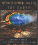
Windows into the Earth: The Geologic Story of Yellowstone and Grand Teton National Parks by Robert B. Smith and Lee J. Siegel, Oxford University Press (2000). ISBN 0-19-510597-4. Paperback. $29.95 |
Also intended for a broad audience, this book provides an extensive look into
the geologic forces that have produced a region of eye-popping beauty marked
by large earthquakes, the famous geysers, and terrain created by volcanoes and
carved by glaciers. The authors make a case that the two parks together represent
a “geoecosystem,” where active geologic forces exert a strong influence
on the living landscape. Well illustrated throughout with full-color maps, diagrams
and stunning photographs, the book conveys what has been learned through years
of intensive study and what still remains to be understood about those forces.
The text reflects the long careers in research and science writing, respectively,
of Smith, a geophysics professor at the University of Utah and recognized expert
on the region, and Siegel, the former science editor of The Salt Lake Tribune.
For those planning a future visit to northwestern Wyoming, fully a quarter of
the book is turned over to a fieldtrip guide for the two parks and surrounding
areas.
 |
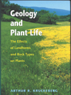
Geology and Plant Life: The Effects of Landforms and Rock Types on Plants by Arthur R. Kruckeberg, University of Washington Press (2002). ISBN 0-295-98203-9. Hardcover, $35 |
Kruckeberg inhabits what he calls the “borderline science of geobotany,” straddling the “academically artificial boundary between botany and geology.” Geoscientists long have been clamoring for broader recognition of a geologic underpinning to ecosystem-based land management, and this book provides a comprehensive and compelling case for how “geology, the fabric of the inanimate environment, influences the manner in which life populates our planet.” Kruckeberg, a professor emeritus of botany at the University of Washington, also looks at how human activity has impacted the relationship between geology and plants.
 |
Geotimes Home | AGI Home | Information Services | Geoscience Education | Public Policy | Programs | Publications | Careers |