
 Most
oil fields need a little bit of coaxing. When oil drillers tap into a new reservoir,
they often have to pump fluids into the ground before any oil comes back out.
Every time fluid enters and leaves the ground, it changes the rock below —
causing it to bend, break or fold. By continuously listening to these changes,
like a doctor listens to a beating heart with a stethoscope, scientists can
monitor the health of the reservoir, says Peter Duncan, president of MicroSeismic,
Inc., in Houston, Texas.
Most
oil fields need a little bit of coaxing. When oil drillers tap into a new reservoir,
they often have to pump fluids into the ground before any oil comes back out.
Every time fluid enters and leaves the ground, it changes the rock below —
causing it to bend, break or fold. By continuously listening to these changes,
like a doctor listens to a beating heart with a stethoscope, scientists can
monitor the health of the reservoir, says Peter Duncan, president of MicroSeismic,
Inc., in Houston, Texas.
Bitumen, or heavy oil, can be difficult
to extract from the ground. The injection of steam into the production well
increases flow of the oil, and a new application of a tool called passive seismic
is allowing researchers to monitor what happens belowground as the steam makes
its way through the reservoir. Courtesy of Syncrude Canada Ltd.
Such real-time monitoring is only one use of an emerging tool called passive
seismic. It’s a new twist on old earthquake technology, allowing oil field
managers not only to measure the movement of fluid belowground — and thus
optimize production — but also to map out reservoirs without the high cost
and environmental impact that often accompany traditional seismic mapping.
Explosive beginnings
One of the major challenges facing petroleum exploration and production is the
uneven distribution of the resource, which makes the extraction of oil and gas
— sometimes abundant in areas that are politically unstable, economically
downtrodden or environmentally sensitive — either impossible or too expensive.
Of the estimated 3 trillion barrels of recoverable oil in the world, 24 percent
has been produced and 29 percent has been discovered, according to an assessment
conducted in 2000 by the U.S. Geological Survey (USGS). Similarly, of the 2.5
trillion barrels of natural gas equivalent, 11 percent of the resource has been
produced and 31 percent has been discovered.
Although the USGS assessment is conservative and does not include all areas
of the world, it shows that much oil and gas remains to be both found and extracted.
New technologies promise to help by better characterizing reservoirs —
thus opening new avenues for exploration and increasing efficiency at fields
already drilled for oil.
Typically, companies use explosives or another source of sound to send waves
through the ground (or the seafloor) in their first step to explore for petroleum.
They measure the travel time and type of waves and use that information to visualize
a reservoir. It’s similar, Duncan says, to the way a bat uses sound to
determine where the objects are in the air.
These sound sources have created controversy in areas such as the Western United
States and in marine environments, when the source (air guns, thumper trucks,
explosives) runs up against environmental restrictions. For example, this year,
environmental groups sued the Bureau of Land Management for approving a project
by Denver-based Bill Barrett Corp., to use thumper trucks for a conventional
seismic survey to explore Nine Mile Canyon in Utah for natural gas (see Geotimes,
July 2004). The lawsuit has since been dropped, but in general, environmental
permitting (and litigation) can add tremendous cost to exploration projects,
in addition to the costs associated with the heavy equipment. In some cases,
potential environmental impacts make exploration impossible. But there is another
way to measure sound waves without using an active source. Earth itself can
provide all the sound waves necessary to map a given spot.
A new view
“Passive seismic uses very much the same equipment for listening, the same
microphones that listen for the sound waves, but this time we’re not going
to use any artificial source,” Duncan says. What the microphones are listening
for are very small earthquakes called microseisms. “These aren’t your
concrete-smashing, building-crushing earthquakes,” he says. “These
are small little creaks and groans that are going off in the planet all the
time as it responds to various tectonic forces.”
It’s all earthquake seismology, says Shawn Maxwell, manager of petroleum
services at ESG Canada in Kingston, Ontario. “The basic science has been
around for years and years,” he says. Indeed, passive seismic studies were
part of an early Moon research project to map its internal structure. And modern
seismic arrays for monitoring earthquakes, such as those in Parkfield, Calif.,
use the same basic technology. “The only new part of what we’re doing
is addressing new problems,” Maxwell says.
The first applications of the technology Maxwell worked with were in mine safety
and for characterizing nuclear waste storage facilities. Over the past decade,
the oil and gas industry has slowly begun experimenting with using natural microseisms
instead of conventional seismic techniques to piece together what the reservoir
looks like in advance of drilling. But passive seismic can also do something
more exciting, Duncan says: track changes in the reservoir over time.
Some companies try to accomplish this task through 4-D conventional seismic
techniques, which are also relatively new, taking several snapshot surveys of
the reservoir over time and then putting them together — “kind of
like going to the doctor and getting an ultrasound or MRI once every four months,
or six months.” But passive seismic is unique in that it can relay real-time
information about changes in the reservoir, thus acting as a “stethoscope
on the chest.”
Here, instead of using Earth’s natural snaps and creaks to map the subsurface,
companies are locating induced microseisms, created by the injection of fluids
to help stimulate or enhance oil production. This new application of the technology
had a huge push forward on the Ekofisk field in the North Sea in 1997. Geologists
with Phillips were producing oil there and noticed that the area was undergoing
substantial subsidence: “The reservoir was compacting and getting thinner
and the platform in the North Sea was getting closer and closer to the water
surface,” Duncan says.
Maxwell, who worked on the monitoring effort, says that they usually would have
used conventional seismology (with air guns) to understand what was happening,
but that the waves would not have been able to properly move through a gas cloud
that was sitting in the center of the field. “It was sort of a blind spot
for reflection seismology, so the idea was to try to listen and see if we could
see the faults just by the induced seismicity,” he says. And it worked:
They were able to map out small-scale faults that may have been difficult to
identify otherwise. That success, Maxwell says, was the start of real-time application
of passive seismic.
Liquid assets
 When Maxwell
was doing his geophysics doctoral work at Queen’s University in Kingston,
Canada, some 10 years ago, the application of real-time passive seismic was
considered the “holy grail” for the oil and gas industry. While the
industry has played with the idea of the technology for years, it has only been
in the last five years that companies have started making these services commercially
available. “There’s been a huge uptake in interest in the technology
and in the number of different companies actually using it,” Maxwell says.
When Maxwell
was doing his geophysics doctoral work at Queen’s University in Kingston,
Canada, some 10 years ago, the application of real-time passive seismic was
considered the “holy grail” for the oil and gas industry. While the
industry has played with the idea of the technology for years, it has only been
in the last five years that companies have started making these services commercially
available. “There’s been a huge uptake in interest in the technology
and in the number of different companies actually using it,” Maxwell says.
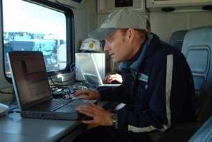
Mike Mayerhofer of Pinnacle Technologies
calibrates a hydraulic-fracture model in real time at a site in Wyoming. Hydraulic
fractures stimulate petroleum flow in a well, and passive seismic data show
geologists and engineers how the fractures are growing, and thus where the remaining
oil is located. Courtesy of Pinnacle Technologies.
The largest application of the technology is for hydraulic fracturing. Once
considered an enhanced recovery technique, hydraulic fracturing is now a standard
practice for drilling in many reservoirs, and particularly in North America,
says Chris Wright, founder of Pinnacle Technologies in San Francisco, Calif.
“We’re stimulating the well to produce more than it could have produced
naturally.” And many reservoirs will not produce oil or gas without such
fracturing, Wright says.
For a typical “frac job,” drillers will pump hundreds of thousands
to millions of gallons of fluid and thousands of pounds of sand or ceramic materials,
called proppant, into the ground to create a fracture that might grow a few
hundred feet to a few thousand feet long. “After the fluid leaks out into
the formation, the proppant stays behind and leaves a conductive pathway from
the rock containing the oil and gas back to your well bore,” Wright explains.
“So now it will flow much more oil and gas after it’s drilled than
it would have if it wasn’t hydraulically fractured.” That pumping
process can take anywhere from half an hour to eight hours, he says.
More than 75 percent of North American oil wells are fractured, Wright says.
While that number is at only 20 percent globally, it will grow to 75 percent
in 20 years, he says. That’s in part because passive seismic is giving
drillers an unprecedented view of the fracture at work, thus increasing its
usefulness to oil drillers.
In the past, the most common thing people did to monitor a hydraulic fracture
was nothing, Wright says. “They pumped a fracture, the production got better,
and everyone was happy.” But sometimes, drillers might have tried to pump
a larger fracture and ended up encountering water or unwelcome gases; they did
not know what was happening belowground, despite some models developed to help
predict fracture growth. “The problem the engineers running the fracs face
is that they do not know what direction the fractures grow in and what kind
of lengths they’re achieving,” Maxwell says.
With passive seismic, drillers can set up an array of sensors downhole, and
a fiber optic or electric wire line will transmit data to the surface. Those
sensors measure acoustic waves, showing changes in the rocks below as the pumped
fluid moves and creates microseisms. And because the data are arriving at the
surface in real time, engineers can make quick decisions regarding the fracture.
“A geophysicist is right there, monitoring the data and running some analysis
software that quickly locates where these microseisms are,” Wright says.
That engineer can then confer with the oil company’s engineer to decide
whether to stop the fracture, expand the fracture or where to move wells to
better follow where the remaining oil is located.
This dynamic process lets the clients decide what to do with their drill holes,
which is especially important, Wright says, considering that oftentimes the
cost of drilling a single well can be in the $1 million range.
The same idea is applicable to secondary recovery techniques, in which drillers
pump steam, gas or water into the drill hole to help bring oil to the production
wells, Maxwell says. In Canada, where ESG operates, steam injection is a popular
technique, as the country’s western half has heavy oil that needs extra
coaxing to be pumped out (see story in this issue).
“The essential question they have is much like for the fracture: Where
is the steam going once it enters the ground?” Maxwell says. As steam enters,
it is under pressure and creates thermal changes in the rock, and thus a huge
change in the material properties of the subsurface. Again, passive seismic
can listen for those changes.
Maxwell points to a recent paper presented at the meeting of the Society of
Exploration Geophysicists (SEG) in October, at which geologist Peter McGillivray
from ShellCanada presented promising results from monitoring a steam-injection
well with passive seismic systems. It was the cornerstone paper, Maxwell says,
of a jam-packed session on various applications of the emerging technology.
At Peace River in northwestern Alberta, estimated in-place reserves are 8 to
10 billion barrels of heavy oil. Although the field has been in operation for
more than 40 years using steam injection to liquefy the oil, no one has been
certain about the processes taking place within the reservoir. At the SEG presentation,
McGillivray reported success in mapping where the steam goes after injection.
Knowing such information, Maxwell says, can help oil drillers identify where
the oil is that might have been missed by the injection process. “The biggest
issue with a lot of oil reservoirs is that you might get 25 percent of the reserves
recovered, and the rest of it would just be bypassed,” he says.
Taking the application a step further, researchers may one day be able to map
out another injection process: carbon dioxide. Many scientists have been exploring
the prospect of storing, or sequestering, carbon from the atmosphere into ocean
or land basins, and using already-drilled production wells might be a good solution,
says Maxwell, who presented a paper on monitoring carbon dioxide injection at
the SEG meeting.
“The carbon-dioxide injection part of the technology is something the industry
is already doing for secondary recovery, to inject gas to help push fluids toward
producing oil,” he says. “Whenever you start to pump something into
the ground, it is always critical that you know where it’s going so that
you don’t have surprises.” In this case, people would be able to find
out if any of the gas is escaping and thus evaluate a reservoir’s carbon
sequestration potential.
Getting smart
Researchers at Pinnacle Technologies have plans to eventually combine passive
seismic with another tool that has been successful in monitoring hydraulic fractures,
a specially designed downhole tiltmeter. Developed by the company, the tiltmeters
measure the actual deformation of rock, Wright says. And like passive seismic,
the technology is still relatively new.
The merging of tiltmeters and passive seismic into a single process to monitor
hydraulic fractures represents a larger trend toward creating a more integrated
system that can continuously monitor reservoir health. Several companies are
working toward that goal in different ways and currently have long-term monitoring
services available.
This trend, Duncan says, is mostly driven from the fact that “at least
in the United States, most of the oil is in the fields we’ve already found,
and what we’re doing is trying to increase our recovery efficiency.”
The idea of a “smart oil field” is to optimize production by making
detailed measurements of what is happening belowground and then trying to adjust
production of that field in real time in response to those observations —
“rather than just sticking a well in and sucking on it,” Duncan says.
It’s new ground, Duncan says, and challenging. “There’s not a
lot of case history — not a lot of doctors you can go to and say teach
me what a good valve and a bad valve sound like,” he says. So a whole new
area of research is trying to better understand how to interpret the data coming
up to the surface.
While companies investigate those new lines of research, other companies, such
as MicroSeismic, are using passive seismic to replace or supplement conventional
explosive seismic surveys in mapping out reservoirs, especially in environmentally
sensitive areas. The oil industry, however, has yet to buy into the idea completely,
Duncan says.
Still, some major oil and service companies, including Shell and Schlumberger
(which is already offering passive seismic services), are experimenting with
real-time monitoring techniques. With time, Duncan says, this type of monitoring
is “going to become something that people are doing as a matter of course.”
Indeed, Wright says that since his company first started more than a decade
ago, it has seen 35 percent growth every year in hydraulic fracturing services
alone. Last year, a total of 500 fractures were monitored with passive seismic,
Duncan estimates. Companies conducted less than two dozen additional projects
for monitoring other fluid or gas injections with passive seismic. “It’s
still a pretty small penetration,” Wright says, but the market will continue
to grow.
For Maxwell, seeing a technology first used to help with mine safety evolve
into a tool for the oil and gas industry, and now potentially into application
for sequestering carbon, is rewarding and exciting. “It’s always interesting
if you can somehow bring in an environmental aspect to your work,” he says.
“It’s nice to have the green side of the technology.”
 |
Geotimes Home | AGI Home | Information Services | Geoscience Education | Public Policy | Programs | Publications | Careers |