
|
 Subscribe

Web Extra Friday, May 25, 2007
Chipping away at Kilauea
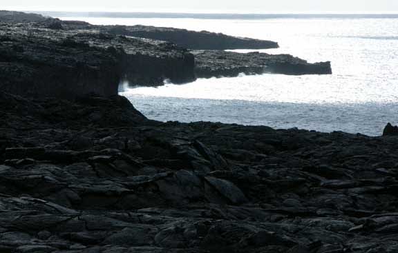 U.S. Geological Survey |
When a large chunk of Kilauea Volcano splashed into the sea earlier this month, scientists initially underestimated its extent. On May 10, the Lae`apuki lava delta, on the volcano's south shore, partially collapsed, forming a large scalloped bay. The area of collapse was originally thought to be 6 hectares (16 acres), but the total area of collapse is now estimated to be 9 hectares (23 acres), according to U.S. Geological Survey's (USGS) Hawaii Volcano Observatory. East Lae`apuki has previously been the site of two of the largest lava delta collapses during the volcano's most recent eruptive period, one of 14 hectares in 1996 and another of 18 hectares in 2005. Other such collapses may occur without warning, according to USGS.
Situated on the southeastern side of the Big Island of Hawaii, Kilauea has erupted 34 times since 1952. The latest period of eruptive activity has been ongoing since 1983, the volcano's longest in more than 600 years, with its most recent eruption on May 24.
Links:
USGS Hawaiian Volcano Observatory
Back to top

