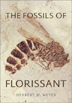
The Fossils of the Florissant
by Herbert W. Meyer.
Smithsonian Institution Press, 2003. ISBN 1 5883 4107 0, Hardcover, $39.95.
Neil H. Suneson

Check out this month's On
the Web links, your connection to earth science friendly Web sites. The
popular Geomedia feature now available by topic.
Book Reviews:
The
Fossils of Florissant
Maps:
Areal mapping applications
|
The Fossils of the Florissant |
People who have visited the Colorado Springs area are more likely to know the
nearby Florissant Fossil Beds National Monument for its petrified sequoia stumps,
rather than for its vast collection of Eocene leaf, insect and spider fossils.
Similarly, the historic gold-mining camps in this part of the Rocky Mountains
undoubtedly hold more allure for tourists than the region’s volcanic history.
Geologists and paleontologists, however, have long recognized that a fortuitous
set of circumstances enabled the preservation of a 34.1-million-year-old ecosystem
on the edge of an ancient lake. The Fossils of Florissant, a recently
published book by Herbert W. Meyer, is a worthy and much-needed attempt to bring
earth scientists’ appreciation of Florissant to the public.
Combining excellent writing, photography and artwork, The Fossils succeeds
where many similar books have failed — in trying to reach both the general
public and the specialist. Had the book cut any corners, it too would have failed
in reaching those often disparate audiences. Published by Smithsonian Books,
the book should serve as a good example for other authors and publishers who
want to excite laypersons and fellow geologists about any aspect of our science.
The Fossils is essentially divided into three parts. The first (Chapters
1 to 4, and the Epilogue) appeals to a wide readership, introducing the importance
of Florissant to paleontologists; the human history of its discovery, research,
exploitation and (finally) conservation; the geologic history and the process
of fossilization; and the concepts of ancient ecosystems and climate change.
Only geologists and the most dedicated laypersons will find the second part
(Chapters 5 to 7) intriguing; it details the fossil trees, plants, spiders,
insects, miscellaneous invertebrates and vertebrates.
I bought the book for its description of Florissant’s fossil forests. Meyer’s
explanation is wonderfully detailed but sufficiently simplified for this paleobotanically
challenged geologist. I suspect many similarly challenged readers will feel
the same about these chapters. The third part (Appendices, including a complete
list of all the fossils at Florissant, museums with specimens and a bibliography)
probably will satisfy even the most particular paleontologist. The book is well-organized
and covers all aspects of Florissant’s geology exceedingly well, and it
does so for a wide audience.
Several parts of the Florissant story deserve repeating here. Discussion of
the enmity between the owners of the then-private Colorado and Pike petrified
forests, now within the national monument, and Walt Disney’s interest in
the properties is fascinating. The formation of Lake Florissant behind a lahar
from the Guffey volcano and the trapping of leaves, insects and spiders in diatom
mats document the special circumstances that enabled the fossil beds to form.
Meyer uses Florissant as an example of how geologists can estimate past climates
from fossils, and to describe the Eocene-Oligocene “greenhouse to ice-house”
transition and the importance of taphonomy (the study of what happens to an
organism between its death and discovery). The descriptions are both clear and
captivating, and could easily serve the needs of a professor teaching introductory
geology.
For earth scientists, the book contains a superb discussion of geographic displacement,
climate change, biotic tolerances and their effects on the Florissant ecosystem.
Meyer discusses more esoteric subjects such as rates of evolution, biogeography
and ecosystem evolution lightly but shows due respect for their complexity.
And for researchers active in the field, Meyer frequently states that there
is still work to be done at Florissant — for example, a shorebird discovered
in 1997 has yet to be described.
The writing moves quickly and, although not needed, is aided by humor, for example,
in his description of the eruption of the Wall Mountain Tuff from near present-day
Mount Princeton preceded Lake Florissant. As if its 160-kilometer-per-hour velocity
and deposition near Castle Rock 150 kilometers away weren’t enough, Meyer
reminds us that “it was a bad day for late Eocene Colorado.” Elsewhere
in the book, to emphasize one interesting conundrum for future researchers (as
well as pay tribute to Pete Seeger), Meyer asks in a subtitle, “Reptiles
and Amphibians: Where Have All The Fossils Gone?”
In addition to the engaging writing, the book contains superb photographs of
fossils, scenic and historical photographs, photomicrographs and illustrations.
The editors wisely did not put scales in the photographs of fossils, although
they appear in the captions. The editors also broke one “rule” to
superb effect — much of the text is repeated in the figure captions, allowing
those who choose not to read the entire book to gain a real understanding of
Florissant geology and paleontology simply by flipping through the figures.
Brilliant! And while perhaps vexing to researchers, the technique of listing
references at the end of the book rather than in the book also works perfectly.
The writing and editing are near-flawless and ideally suited for the public
and any student or researcher of geology and paleontology. Although good definitions
appear in the text, I wish the book had a glossary. I wish the table of contents
included the subheadings used throughout the book. I wish that the time scale
(Fig. 18) showed the correct age of the Miocene and Pliocene and that the one
typo I found on page 68 wasn’t there. But mostly, I wish that more of us
who attempt to write books for a wide audience would use The Fossils of Florissant
as a model.
A new mapping project is helping local communities better address a range of
challenges — from delineating seismic hazard zones and geotechnical engineering
to managing groundwater resources and land use. Conducted jointly between the
U.S. Geological Survey (USGS) and the California Geological Survey (CGS), the
Southern California Areal Mapping Project — SCAMP — is a regional
geologic mapping project that began in 1991. Funding for this project comes
from the USGS National Cooperative Geologic Mapping Program, the CGS Regional
Geologic Mapping Project and a variety of outside sources.
Water is a vital issue in Southern California, both as a resource and as a flood
hazard. Several new dam construction projects used SCAMP geologic maps to better
understand the geologic setting of proposed dam sites. In San Diego County,
the county water authority made use of such data in planning Olivenhain Dam,
the largest dam constructed in the county in the past 50 years. In Riverside
County, the Metropolitan Water District used geologic mapping in site selection
and preliminary evaluation for its Diamond Valley Reservoir, a complex of three
dams forming the largest reservoir in Southern California. Farther north, in
San Bernardino County, the Army Corps of Engineers used geologic maps at the
Seven Oak Dam, a major flood control facility.
Optimizing surface-water and ground-water resources is of increasing significance.
Most of this work integrates surface maps with a variety of subsurface data.
USGS cooperative projects have included those with the San Bernardino Valley
Municipal Water Agency in the San Bernardino basin; the San Gorgonio Pass Water
Agency in regional studies in the greater San Gorgonio Pass area; the Eastern
Municipal Water District in the San Jacinto Basin; the U.S. Marine Corps Air
Ground Combat Center at Twentynine Palms; and the Mojave Water Agency in a variety
of locations including Lucerne Valley, El Mirage Lake, Mojave River and Yucca
Valley. USGS used regional mapping in its investigation of groundwater quality
in the Santa Ana Watershed (Water Resources Investigations Report 02-4243).
Regional geologic maps as GIS layers have aided land-use studies, including
those from the U.S. Navy on the Chocolate Mountain Aerial Gunnery Range, and
the U.S. Forest Service for the San Bernardino and Cleveland national forests.
Geologic maps in GIS helped produce landslide maps for the Santa Monica Mountains
National Recreation Area.
Additionally, detailed mapping of active faults in Southern California has led
to several major tectonic syntheses of the San Andreas fault system (for example,
the Geological Society of America Memoir 178). New mapping in the Big
Bend area of the San Andreas fault has shown that the enigmatic Big Pine fault
is different from how it was previously depicted; instead, it consists of two
unrelated faults, thus changing the seismic potential for the area.
Coupling mapping with other databases, such as isotopic chemistry and geophysics
has yielded new insights to the basic geology of Southern California. Mapping
combined with strontium data and gravity measurements indicated that the San
Jacinto fault, the most active fault in Southern California, developed along
a basement rock boundary.
Some of the other varied uses of geologic mapping were a better understanding
of subsidence and ground fissuring at the shuttle landing site at Edwards Air
Force Base; regional tectonic analysis of fault location and activity for engineered
structures; better understanding of the habitat of the endangered fringe-toed
lizard; and development of debris flow susceptibility maps extending from Santa
Barbara County south to San Diego County (USGS Open-file report 03-17).
SCAMP maps also helped discover a previously unrecognized major Cretaceous intrabasin
suture; mapping combined with isotopic geochemical data resulted in new basic
understanding of the Cretaceous Peninsular Ranges batholith.
SCAMP geologic maps from
the California Geological Survey:
Open-File Report 96-02. Geologic maps of the northwestern part of San Diego County, California, by S.S. Tan and M.P. Kennedy. 1999. Scale 1:24,000. Plate 1, Geologic maps of the Oceanside, San Luis Rey, and San Marcos 7.5’ quadrangles, Plate 2, Geologic maps of the Encinitas and Rancho Santa Fe 7.5’ quadrangles. Available for $8.00 from California Geological Survey.
Open-File Report 98-29. Geologic map of the El Monte 7.5’ quadrangle, Los Angeles County, California: a digital database, by S.S. Tan. 2000. Scale 1:24,000. Available for $14.00 from California Geological Survey.
Open-File Report 98-30. Geologic map of the Baldwin Park 7.5’ quadrangle, Los Angeles County, California: A digital database, by S.S. Tan. 2000. Scale 1:24,000. Available for $14.00 from California Geological Survey.
Open-File Report 98-31. Geologic map of the San Dimas 7.5’ quadrangle, Los Angeles County, California: A digital database, by S.S. Tan. 2000. Scale 1:24,000. Available for $14.00 from California Geological Survey.
Open-File Report 99-04. Geologic map of the Whittier 7.5’ quadrangle,
Los Angeles and Orange counties, California, by G.J. Saucedo (compiler).
1999. Scale 1:24,000. Available for $10.00 from California Geological Survey.
For more SCAMP maps, click
here, or go to the California
Geological Survey Web site. To Order these and other maps from the
California Geological Survey, write to California Department of Conservation,
California Geological Survey, Attention: Publication Sales, 1059 Vine Street,
Suite 103, Sacramento, Calif., 95814-0321.
More maps, available free online
from the USGS and California Geological Survey (click
here):
Geologic map of the Valley Center 7.5' quadrangle, San Diego County, California,
by M.P. Kennedy. 1999. Scale 1:24,000.
Geologic map of the Dana Point 7.5' quadrangle, San Diego and Orange counties,
California, by S.S. Tan. 1999. Scale 1:24,000.
Geologic map of the San Clemente7.5' quadrangle, San Diego and Orange counties,
California, by S.S. Tan. 1999. Scale 1:24,000.
Geologic map of the San Onofre Bluff 7.5' quadrangle, San Diego and Orange
counties, California, by S.S. Tan. 1999. Scale 1:24,000.
Geologic map of the Escondido 7.5' quadrangle, San Diego County, California,
by S.S. Tan and M.P. Kennedy. 1999. Scale 1:24,000.
Geologic map of the Pala 7.5' quadrangle, San Diego County, California,
by M.P. Kennedy. 2000. Scale 1:24,000.
Geologic map of the Pechanga 7.5' quadrangle, San Diego County, California,
by M.P. Kennedy. 2000. Scale 1:24,000.
Geologic map of the Bonsall 7.5' quadrangle, San Diego County, California,
by S.S. Tan. 2000. Scale 1:24,000.
Geologic map of the Fallbrook 7.5' quadrangle, San Diego County, California,
by S.S. Tan. 2000. Scale 1:24,000.
Geologic map of the Temecula 7.5' quadrangle, San Diego County, California,
by S.S. Tan and M.P. Kennedy. 2000. Scale 1:24,000.
Geologic map of the Margarita Peak 7.5' quadrangle, San Diego County, California,
by S.S. Tan. 2001. Scale 1:24,000.
Geologic map of the Las Pulgas 7.5' quadrangle, San Diego County, California,
by M.P. Kennedy. 2001. Scale 1:24,000.
Geologic map of the Morro Hill 7.5' quadrangle, San Diego County, California,
by S.S. Tan. 2001. Scale 1:24,000.
Geologic map of the El Cajon 7.5' quadrangle, San Diego County, California,
by S.S. Tan. 2002. Scale 1:24,000.
Geologic map of the Jamul Mountains 7.5' quadrangle, San Diego County, California,
by S.S. Tan. 2002. Scale 1:24,000.
Geologic map of the San Vicente Reservoir 7.5' quadrangle, San Diego County,
California, by S.S. Tan. 2002. Scale 1:24,000.
Geologic map of the Otay Mesa 7.5' quadrangle, San Diego County, California,
by S.S. Tan and M.P. Kennedy. 2002. Scale 1:24,000.
 |
Geotimes Home | AGI Home | Information Services | Geoscience Education | Public Policy | Programs | Publications | Careers |