Geotimes

Profiles:
News about people from AGI and its 41 member societies
Jim
Davis: Lessons from Josiah Whitney
Jan
Childress
Sidebar:
Changing of the
guard
The online version of this profile is different from
what appears in the print edition of Geotimes.
 Relief is clear
in Jim Davis' voice. In late July, the state legislature voted to spare two
earthquake initiatives of the California Geological Survey (CGS), strong-motion
monitoring and seismic-hazard mapping — programs that had been on the chopping
block for months. Technically, the budget is no longer his concern because Davis
retired on June 30, after more than 25 years as California's state geologist.
Still, he hated to watch programs he had helped to develop and nurture —
programs that were protecting millions of Californians — voted out of existence.
Relief is clear
in Jim Davis' voice. In late July, the state legislature voted to spare two
earthquake initiatives of the California Geological Survey (CGS), strong-motion
monitoring and seismic-hazard mapping — programs that had been on the chopping
block for months. Technically, the budget is no longer his concern because Davis
retired on June 30, after more than 25 years as California's state geologist.
Still, he hated to watch programs he had helped to develop and nurture —
programs that were protecting millions of Californians — voted out of existence.
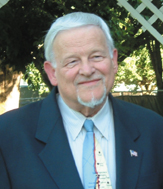
Jim Davis stepped down
this summer from his position as California's state geologist. (Photo courtesy
of Jim Davis.)
Most of the nation's state surveys have weathered survival crises before. As
each state came into the union, a geological survey was set up to inventory
its mineral resources. Once the initial work was done, however, state legislatures
often disbanded the surveys, only to realize a need for them later. Davis describes
with relish the experiences of California's first state geologist, Josiah Whitney
(as in Mount Whitney). During the Gold Rush era, California's entrepreneurs
and lawmakers were eager for regional reports on minerals, including gold-bearing
gravels. In 1860, they created the Office of State Geologist and gave Whitney
a broad mandate. Whitney was a visionary but he lacked the necessary focus.
Instead of mineral reports, his first volume was on paleontology, which he insisted
on shipping for publication to Germany, where the best lithographic work was
done. Enraged, the lawmakers abolished his job and the survey. When the legislature
created a similar organization nine years later, they called it the State Mining
Bureau. Its focus was specifically on mining and mineral resources and the new
director was called "state mineralogist."
"All surveys can learn from Whitney's mistakes," Davis says. "You
have to be focused on your organization's mission and understand what the users
of your products want and why you're being supported. And you must communicate
in a way that they can understand."
| Changing
of the guard
Seven state geologists have retired during the past year. The length
of their service adds up to 116 years, an impressive amount of “institutional
memory.” Long-serving former state geologists become honorary members
of the Association of American State Geologists, which currently has 51
members (including Puerto Rico) and 60 honorary members.
James F. Davis, New York, 1968; California,
1978
Robert R. Jordan, Delaware, 1969
Earl H. Bennett, Idaho, 1988
Vicki J. Cowart, Colorado, 1993
William V. Bush, Arkansas, 1995
Milton A. Wiltse, Alaska, 1995
Ralph S. Lewis, Connecticut, 1997
|
Geoscience public policy has intrigued Davis since the earliest days of his
career as head of the Mineral Resources Program for the New York Geological
Survey; when he became New York's state geologist in 1968, he fully realized
its importance. The environmental consciousness movement was sweeping the United
States, and geologists were essential to implementing new water-quality and
land-use laws. "It was a very exciting period because we were looking at
issues that had not been holistically addressed from a geologic point of view
before," Davis recalls. "The common issue was urban waste landfills.
There wasn't a state in the union that didn't have to comply with Environmental
Protection Agency regulations to protect their surface water and groundwater.
State governments needed accurate appraisals of subsurface geology in order
to comply with the regulations, and the surveys provided that expertise through
environmental impact studies, mapping and other geologic investigations."
Davis applied geologic mapping to many environmental projects in New York. He
also spearheaded the development of a seismic monitoring system to investigate
whether deep-well injection of industrial waste could trigger small earthquakes
and to evaluate the seismic setting of proposed nuclear power plants.
Geologic mapping, once the raison d'etre for a state survey, had gone
into decline after World War II. When Davis moved to California in 1978 as director
of the California Geological Survey, he re-established that organization's regional
geologic mapping program.
In 1971, seven years before his arrival, the San Fernando Earthquake had killed
65 people in central Los Angeles County and caused more than $500 million in
damages. It was the first earthquake to stress the state's modern infrastructure,
including the freeway system. A year later, two laws were passed that were designed
to help communities avoid similar catastrophic losses in the future. The Alquist-Priolo
Special Studies Zone Act assured that buildings for human habitation are not
placed directly on active fault traces and the Strong-Motion Instrumentation
Program (threatened with elimination last July) established a statewide network
of seismic monitoring instruments to record measured strong ground shaking immediately
after a significant earthquake.
Following the Loma Prieta Earthquake of 1989, Davis and his colleagues worked
for passage of the Seismic Hazards Mapping Act, which gave the survey responsibility
for identifying post-earthquake liquefaction zones. The strong-motion program
and the mapping program also help emergency response agencies develop plans
for coping with post-earthquake problems. The mapping program, too, was nearly
abolished this past summer.
"The Seismic Hazards Mapping Act turned out to be a clairvoyant piece of
legislation because in 1994, the Northridge Earthquake led to a great deal of
earthquake-induced landsliding," Davis says. Among the act's provisions
are requirements for local governments to approve new construction projects
within mapped CGS hazard zones after on-site hazards have been investigated
and necessary mitigation strategies have been included in the project design.
The survey must produce zone maps of the area, showing the general locations
of earthquake-induced landslides and liquefaction at the 1:24,000 scale.
Public policy issues will continue to drive new applications of geology, Davis
predicts, as government agencies work to hold down or reduce their costs while
serving a growing population. The issue of landslide hazards vis à vis
new construction in California provides an example.
"Our state's population has increased to the point that in many places
we are no longer building on flat bottom lands," he explains. "We
must determine which sites are most suitable for development and which are potentially
hazardous. When development is permitted, building and foundation designs should
be able to minimize future damage. To be economically efficient, the general
extent of hazardous areas in California are defined at the regional level by
the public sector with on-site investigations within those areas that are conducted
and financed by developers.
Digital technology will also continue to transform the way state surveys provide
data and services (for example, California's real-time seismic monitoring program)
and how they connect with the public. The web offers a broad range of communication
possibilities that are both a boon and a challenge, Davis says. Reams of information,
offered at no cost, are just a few clicks away from the user; but the surveys
must also determine when it is appropriate to charge for information in order
to recover their investment costs. All the state surveys (as well as publishers
and many other organizations) are still sorting out these information transfer
questions, Davis says. They will remain policy issues as well as financial challenges
for some time to come.
How the surveys apply their financial resources to deal with these and other
issues will also change, he adds. "I believe we will see continued transitioning
from appropriated funds to outside grant or contract funds that are consistent
with an organization's mission. We must continue to do regional mapping and
we will use our mapping and GIS capabilities, as well as our understanding of
engineering geology and the basic geology of our state to better serve our citizens."
Despite his retirement, Davis, who was president of the American Geological
Institute (AGI) in 1987, plans to remain involved with AGI and other professional
societies and organizations.
Childress, former managing editor
of Geotimes, is a freelance writer and editor in Washington, D.C. E-mail her at
janochil@aol.com.
Archive of
past Society Page/Profiles stories by date
