
|
News Notes Geoarchaeology Dates help paint picture of early migration
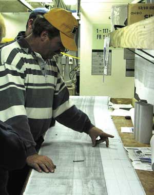
Neal Driscoll looks at seismic data collected from the Arctic during an expedition to try to determine when the Bering land bridge between Russia and Alaska was submerged, closing off the supposed migration route into the Americas. Photograph is courtesy of Julie Brigham-Grette. During the last ice age, large quantities of the ocean’s water were trapped in glaciers, lowering global sea level, exposing the continental shelf and creating a wide “land bridge” across what is now the Bering Strait. Terrestrial fossils in cores collected two decades ago from the Chukchi Sea suggest that the Bering Strait flooded around 13,000 years ago, cutting off any migration route for humans and megafauna, says Julie Brigham-Grette, a geologist at the University of Massachusetts in Amherst. But the samples that had shown the earliest dates for the flooding were less reliable than they could have been, Brigham-Grette says. Trying to constrain when the strait flooded and closed off that migration route, Lloyd Keigwin of the Woods Hole Oceanographic Institution and colleagues, including Brigham-Grette, surveyed and drilled cores into the Bering and Chukchi seas in the Arctic. Isotopic, marine fossil and sediment analyses from the team’s cores indicate that the Bering Strait flooded sometime shortly before 12,000 years ago, as they reported in the October Geology. Keigwin and colleagues found that increases in carbon-13 isotopes around 12,000 years ago were consistent with a change from estuarine to open-ocean conditions, as was an abrupt change in sediment grain size. Furthermore, small marine creatures called foraminifera found in the cores reflect an increase in salinity consistent with the flooding of the strait. The dates make sense, says Scott Elias, a geographer at Royal Holloway, University of London in the United Kingdom, who originally dated the Chukchi terrestrial fossils to 13,000 years ago. Even though the new dates are slightly younger, they are consistent with what he found, as Elias had dated terrestrial fossils from before the flooding, and Brigham-Grette and colleagues dated marine fossils from shortly after the flooding, Elias says. Keigwin’s team captured sediments that hadn’t been dated before, and retrieved “a nice, high-resolution record” of the inundation, Elias says. “It’s an interesting contribution to the debate,” he says, further supporting what has recently been postulated — that if humans walked across the land bridge, they probably did so prior to 12,000 years ago. And indeed, archaeological evidence points to human settlements in Siberia as much as 30,000 years ago, Brigham-Grette says, so it is possible people were migrating across the land bridge or even via boats as far back as that, following game. The next questions to answer will be what conditions the early explorers faced, such as the amount of sea ice, what the landscape looked like and if it could have supported life or if it was merely a causeway, Brigham-Grette says. This research helps paint a better picture of the geography and history of this area, she says. “Now it’s up to the archaeologists to run with it.” Megan Sever Links:
|
 |
Geotimes Home | AGI Home | Information Services | Geoscience Education | Public Policy | Programs | Publications | Careers |
 Subscribe

 Geologists and archaeologists are both trying to solve the puzzle of how and when the first settlers migrated to the Americas. Archaeologists are looking at evidence of early settlements, while geologists are trying to piece together the history of the Bering land bridge that once linked Asia to North America. New radiocarbon dates from marine sediments in the Arctic are helping geologists better create a timeline for their piece of the puzzle, which could in turn help archaeologists with their job.