
|
 Subscribe

DOWN TO EARTH WITH...: News about people from AGI and its 44 member societies
Archive of past profiles stories by date
Ruth DeFries
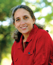 Courtesy of Ruth DeFries |
As an environmental geographer at the University of Maryland in College Park, Ruth DeFries says she’s interested in studying the “interaction between human societies and the environment.” In particular, she is trying to learn more about our relationship with the world’s tropical forests, and is investigating how the changes we make to these forests affect Earth’s biochemical processes. Her work is especially timely, as she is helping scientists better understand the role that forests play in the carbon cycle and what might happen in the future if society continues to release larger volumes of carbon dioxide into the atmosphere, while at the same time cutting down bigger swaths of forest.
Although DeFries has traveled to the tropics to examine the effects of deforestation firsthand, she spends most of her time poring over remote-sensing data collected by satellites such as Landsat. In 2007, she won a MacArthur Fellowship (called the genius grants), in part because of her contributions to improving our ability to more accurately map out changes in the planet’s landscapes. DeFries recently spoke with Geotimes reporter Erin Wayman about her work.
EW: I imagine that you spend a lot of time looking at satellite images and tracking changes over time.
RD: Yes, that’s part of it. The next part of it is: What does that mean for greenhouse gas emissions? Or for conservation and biodiversity? We’re trying to get a comprehensive understanding of where changes are taking place and what the implications are for a range of ecosystem services. And then how we can use that understanding to provide information about how we can both meet the needs for these ecosystem services and the humans that depend on them in a way that has the least negative consequences.
EW: Where do you get your satellite data?
RD: Many countries have satellites that are appropriate for looking at this issue. There are also some long-term datasets, which are very helpful but are of a coarser resolution. We’ve worked with using that type of long-term record, which gives us a good picture because it’s comprehensive and covers an entire area, but it’s fuzzier. It’s like taking off your glasses and looking at something.
EW: What are some trends in this field?
RD: We used to think of tropical deforestation as a process that occurred with people moving into the forest for subsistence with small clearings — very population driven. Now what we’re seeing is very different. Of course, that is still a process, but we’re also seeing a very commodity-driven, industrial-level deforestation: clearing for the commodity production of beef, different crops and now biofuels.
EW: Has this been a steady change or one that’s happened suddenly?
RD: You would think we would have a good handle on understanding just what the rates of deforestation are across the tropics. But we don’t really. It’s surprising.
EW: Do you find there’s more interest in your research now given the recent public awareness of climate change and the effects of carbon emissions?
RD: Yes. Right now there’s a very heated policy discussion about whether developing countries should be able to get carbon credits for reducing deforestation in the post-Kyoto commitments during the next round of the climate convention [a plan called REDD (Reducing Emissions from Deforestation and Degradation)]. Deforestation was not in the equation because it was thought that it was too hard to monitor and measure. But we do know that tropical deforestation contributes to greenhouse gases. The question is how would that be measured? How would those policies be crafted?
EW: Are you involved in policy?
RD: Obviously, I think it’s an important issue. Otherwise I wouldn’t be working on it. But I don’t engage directly in the policy discussions in terms of saying what the policy should be, but instead by providing the technical end that supports the ability to move forward with these policies.
EW: How did you become a MacArthur Fellow?
RD: It just fell out of the sky, completely out of the blue.
EW: What’s it like to be called up and told the news?
RD: It was surprising, certainly unexpected. A little humbling. It’s a huge honor. I hope I can do some good work to live up to it.
EW: Do you know what you will do with the grant money?
RD: I’m starting a foundation with it. I hope to use part of it to support science and scientists in developing countries to really think about these big issues of sustainability and how we move forward with development in a way that is sustainable.

