|
DOWN TO EARTH WITH...: News about people from AGI and its 44 member societies
Archive of past profiles stories by date
David Applegate
 Margaret Baker |
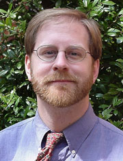
| Geologist David Applegate heads the U.S. Geological Survey’s Earthquake Hazards Program. |
David Applegate has been many things: a historian, a geologist, a Congressional Science Fellow (sponsored by the American Geophysical Union), the director of Government Affairs (from 1996 to 2004) at the American Geological Institute and — full disclosure — editor of Geotimes from 2000 to 2004.
The connection between these disparate jobs, Applegate says, is that they use different means to a similar end: to connect and apply science to society. In his current role as head of the U.S. Geological Survey’s (USGS) Earthquake Hazards Program in Reston, Va., Applegate applies science to society in an even more immediate way: He coordinates USGS geohazard activities, which focus on ways to reduce the societal impacts of natural hazards.
Applegate talked with Geotimes reporter Carolyn Gramling about the many hats he has worn.
CG: You chose to major in geology over history (as an undergraduate at Yale) after reading John McPhee. How did that happen?
DA: My older brother read the McPhee articles back when they were first published in The New Yorker. Then he gave me Basin and Range, and I developed this hopelessly romantic view of geology from that. It seemed like a fascinating way to apply the same kinds of analytical approaches one took to human history — but taking it back a few million years.
CG: USGS seems like a good place for you to be, because it’s so closely tied to the history of geology in the United States.
DA: That’s right; that’s one of the humbling things about working at USGS — the tremendous history there, the accumulated accomplishments. But it’s also wonderful to see how this common thread of how science applies to society carries forward. Once I became a geologist, I didn’t lose that interest in society, in politics, and so working for a place that doesn’t do science just for its own sake, but also for society’s sake, was very appealing.
[Coordinating geohazards] is a wonderfully straightforward mission; you get up in the morning and you know exactly why it is that you’re doing this job. My challenge is to be credible in communicating what we’re doing to other audiences. Whether I go on CNN or talk to the Department of the Interior, I’m trying to be that translator.
CG: Do news outlets tend to get the story right?
DA: It’s generally been positive. With hazards, a lot of interaction tends to be of the moment, the morning after or a few hours later. An event has happened and people want to have Earth explained to them, why is their planet behaving this way. … And there’s a fine line to walk between “these are the teachable moments” to communicate about how Earth works and also safety messages, and at the same time convey that something very bad has happened.
CG: What’s a situation where you had to think on your feet and respond very quickly?
DA: One of the things we deal with is earthquake magnitude. We try to report as quickly as possible on the size of an earthquake and whether it will be a humanitarian issue or not. But we’re going to be collecting additional information for several hours, and the magnitude can change. So you have to be clear about that possibility while keeping the press from getting hung up on it and making that the story.
In terms of my oddest interaction with the media, the day after the [2004] Sumatra-Andaman quake, I ended up on Crossfire. The Rev. Al Sharpton was sitting in on the left, and Robert Novak was sitting in on the right. Of course, this was not a partisan issue, and the questions, for the most part, were simply trying to understand what really happened. But then Al Sharpton wanted to know if I thought environmental groups would ascribe this to global warming! I had to think — he wasn’t asking me if I thought it was, but what they would think. [laughs] And then I went into some discussion about deep forces within Earth, and that I didn’t think it was connected.
CG: What’s the main message you’d want to communicate to the public about earthquakes and other geohazards?
DA: One is that these are national hazards. People tend to think about earthquakes as happening somewhere else. But some of the greatest risk is in the areas where we have relatively infrequent events, because you have greater vulnerability. It has been said that earthquakes don’t kill people, buildings kill people. That’s an awareness issue — hazard is inevitable, but disaster is not.
Also, in the case of [the magnitude-8.4 earthquake on Sept. 12 in] Sumatra, we helped people understand that we have the same kinds of features [in the United States] and we have subduction zones off our own coast. That was also a teachable moment for the central United States, because here is an event that probably last occurred off of Sumatra several hundred years ago, and just as several hundred years ago we had the New Madrid earthquakes. But when they do occur, that’s how real that is. These disasters aren’t just something that happens somewhere else
CG: How would hazard awareness translate to action in communities, such as around the New Madrid Fault Zone?
DA: Probably the most important way is through the building code process. There are three things that USGS does with respect to earthquake hazards: monitoring, targeted research and hazard assessment. That’s a prediction of the likelihood of shaking over a 30-year or 50-year period at different frequencies and so forth. We don’t have a national building code, there’s no federal building code that is forced upon everybody. So as a result you get quite a range of adoptions.
The national seismic hazard map is our flagship product. And that gets translated into model building codes that get adopted by local jurisdictions. It gives a snapshot of what is likely to be faced in the lifetime of buildings. In the central United States, we saw a shift initially toward greater awareness and improved building codes, but Memphis [Tenn., near the epicenter of the 1811 and 1812 New Madrid earthquakes] recently adopted a lower building code and this is the challenge with the hazards: How to keep the hazards real.
CG: How do you keep rare hazards real to the public?
DA: One approach that’s been very effective is developing scenarios. In Seattle, there’s a Cascadia regional earthquake working group that’s working with structural engineers and planners and emergency managers — they took the hazard info that USGS generates and really fleshed that out. So if this event happened on the Seattle fault, they can assess what the impact would be on schools or on lifelines.
One of the really wonderful things going on right now is a multi-hazard demonstration project in Southern California with the overall goal to improve information that we communicate to emergency management community about not just earthquakes but also coastal erosion, flash flooding and wildfires. We’ve asked them what improved information they need from us, what kinds of things would be helpful, and what they came back with was scenarios. The first one of these is going to be focused on a major event on the southern San Andreas Fault, which hasn’t ruptured since the 17th century: not just thinking about the earthquake, but also about triggered landslides and the potential for dam failure. And wildfires are a huge issue because there are a lot of lifelines crossing the fault, such as gasoline pipelines, that would affect our ability to get in and deal with that.
That will become the basis for a major public preparedness exercise in 2008 called the Golden Guardian exercise, which will be done by the California Office of Emergency Services along with FEMA. What they’re hoping is to have it not just be a tabletop exercise within the emergency management community, but have it be a true public preparedness exercise — so they’re working with the Los Angeles school district and chambers of commerce, so that businesses and schools would be practicing preparedness at the same time. And that’s a whole other way of trying to make the hazard real.
CG: Have the public and the media become more savvy about how science works?
DA: The challenge I see is one of constantly rising expectations. All we used to provide were the magnitude and location for an earthquake, but now we’re providing people with images, shake maps and a sense of the intensity in different locations. And we’ll be launching the PAGER system (Prompt Assessment of Global Earthquakes for Response), which takes a shake map for a large earthquake anywhere in the world and overlays the population density on it, to be able to say within about 20 minutes whether a large population will likely be exposed to violent shaking or not. One of the biggest challenges for USAID, Mercy Core, the Red Cross and other humanitarian response and recovery groups after a global event is that communications may be out for days before we have a sense of the full scope of a tragedy, and this way they can start to mobilize much more quickly.
But as we provide this additional information we need to be sure that we’re also conveying that there’s a tradeoff between speed and uncertainty, and that our understanding will change. We have to be very up front about that.
CG: Do you find any issue with getting the public to trust the credibility of USGS?
DA: That’s where the history comes in handy. The survey has a long track record of providing objective information and not blowing with political winds, and that’s very valuable. We’re also very aware that you have to re-earn that every time. The scientific information should be presented in as straightforward, clear and consistent a way as possible, and that can be a real challenge. Being able to provide a consistent message when the media goes to all of our offices is a challenge — you’re always caught between providing as much information as you can as fast as possible, and wanting to collect as much as you can before saying something.

 Subscribe


